Fife Coastal Path
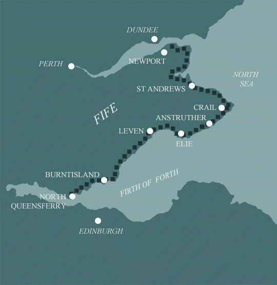
North Queensferry to Newport-on-Tay in 5 Days Walking Code: FC6
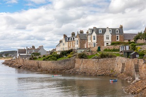
We offer 2 itineraries covering the whole Fife Coastal Path. Walk from North Queensferry, with its stunning views of the Forth Bridges and Edinburgh skyline, to Newport-on-Tay, following clifftop trails, woodland paths, and sandy dunes. Along the way, explore volcanic landscapes, nature reserves, and charming coastal villages with historic harbours.
This 5 day walk is perfectly achievable by strong walkers used to longer days, but it does involve 2 lengthy distances at the end. If you have more time, perhaps consider our 6 day walk which is a little less demanding over the second half of the walk.
| Miles | Km | ||
|---|---|---|---|
| Day 1 | Travel to Burntisland for your first nights accommodation | ||
| Day 2 | Transfer to North Queensferry then walk to Burntisland | 14 | 23 |
| Day 3 | Burntisland to Leven | 15 | 24 |
| Day 4 | Leven to Anstruther | 15 | 24 |
| Day 5 | Anstruther to St Andrews | 19 | 31 |
| Day 6 | St Andrews to Newport-on-Tay then transfer back to St Andrews | 18 | 29 |
| Day 7 | Depart from St Andrews after breakfast |
North Queensferry to Burntisland
Your journey begins by the Waterloo Well also known as Napolean Well at the bottom of ‘The Brae’ on Ferryhill Road. Immediately we have a history lesson and our first taste of Scots dialect. A brae is a Lowland Scots word for the slope or brow of a hill. The well, shaped like Napoleon’s hat, was built to commemorate Wellington’s victory over Napoleon at Waterloo in 1815.
At the Scottish Wildlife Trust Nature Reserve by Carlingnose Point look out for the magenta-coloured bloody cranesbill, burnet saxifrage and best of all dropwort, rarely seen in Scotland. Out at sea stand the remains of the old pier, a home now for nesting birds.
Woodland leads to Inverkeithing and St David’s Harbour. From here the path hugs the coastline to Dalgety Bay. Once a fishing village the old Dalgety Bay made way for the new town in the 1960’s. All that remains of the old town is the ruin of St Bridget’s Kirk. In summer, terns can be observed plunge diving for fish in the bay. Eyes are drawn out to Inchcolm Island with its 12th century Abbey before turning inland and on to Aberdour.
Beyond Hawkcraig Point and the expansive Silversands Bay there is more woodland. This stretch is popular with botanists and bird watchers and is home to the impressive Starley Burn Falls. Once out the woods, a short section of urban walking leads to Burntisland. Look out for the seals basking on the rocks.
Burntisland to Leven
Leaving Burntisland, the path remains on the road for a time before rejoining the shoreline at Kinghorn. The Fife Coast and Countryside Trust were keen for the path to be, as far as possible, accessible at all states of the tide. Being too close to the shore here would result in the path being under water at high tide. Fortunately, you remain rewarded with fine views to the shore. Keep an eye out for the monument marking the place where Alexander III died in 1286.
Beyond Kinghorn on to Kirkcaldy you walk through coastal grassland. Rockrose, agrimony and wild clary all grow here. Many rocks here are the product of lava flows following the eruption of the Binn Hill volcano around 300 million years ago. Layers of limestone sit beneath the lava flows and hold fossils of sea life from a time when Scotland, then at the Equator, had a tropical climate.
Leaving Kirkcaldy behind you reach the picturesque village of Dysart, whose history dates back to beginning of Christianity in Scotland. At the foot of Hot Pot Wynd stands the Harbourmaster’s House. Now a Coastal Visitor Centre, bistro and home to Fife Coast and Countryside Trust.
The final stretch towards Leven initially skirts woodland carpeted in spring with anemone, lesser celandine and primrose before reaching the famous Wemyss Caves. The caves are decorated with Pictish markings dating back to between AD500 and 900. The path then follows the old railway line into Buckhaven ahead of your arrival at the golden sands of Leven Links.
Leven to Anstruther
Leven and Shell Bay are linked by the sandy shores of Largo Bay. A beautiful 7 mile stretch of beach punctuated in the middle by the pretty village of Lower Largo. Sanderlings, oystercatchers, curlews and ringed plovers can all be enjoyed along this stretch of coast. As can common seals and the larger, ‘roman nosed’ grey. If you’re fortunate, you may even catch a glimpse of bottlenose dolphins. The path skirts the sands and is bordered with wildflowers such as purple milk vetch, rest harrow and lady’s bedstraw.
From Shell Bay the path climbs a series of raised beaches to Kincraig, illustrating the varying sea levels through the ages. From here you are rewarded with stunning views of Earlsferry Bay and beyond. Elie to Anstruther proves great walking over the grassy links with plenty of sites of interest. Elie Ness Lighthouse and Sauchar Point Watch Tower both deserve time spent there. Onwards and the path turns a little rougher as you approach Ardross Castle and beyond there Newark Castle ahead of the village of St Monans with its magnificent windmill.
Out from St Monans and only Pittenweem stands between you and Anstruther, but take your time, there’s much to see. In Particular St Fillan’s Cave. Thought to be where St Fillan lived whilst converting the Picts to Christianity in the 7th century.
Anstruther to St Andrews
Please note there are tidal points between Crail and St Andrews were you may have to wait until the tide recedes and the path is clear. Please check tide times before setting off.
Heading first for Crail, the path follows the rough, grassy shoreline which is uneven in places with some rocky stepping-stones to negotiate. Best then to stop and stand still as you look out to the Isle of May. Consider having a rest day here and take a boat trip out to the island.
Midway between Anstruther and Crail are the fascinating Caiplie Caves. Eroded over time by weather and sea, the caves were once part of a sea cliff. Take care if observing them as several years ago one of the smaller caves collapsed without warning. This boulder-strewn coast is awash with wildflowers and shrubs providing cover for nesting birds such as whitethroat and sedge warbler.
Take time to savour Crail harbour before following a mixed terrain of tarmac roads and rocky shoreline as you head for Kingsbarns. Kilminning Wildlife Reserve with its migratory birds is a highlight of this section. At low tide Kingsbarns beach will provide plenty of wildlife interest also.
From here the walk to St Andrews is along a lonely stretch of coast, rough in places and occasionally muddy. Wading birds are common here. Eider and sometimes shelduck can be seen. Knapweed, campions and vetches provide colour. Although rough underfoot in places this stretch of coast is both beautiful and fascinating. Look out for the impressive pink sandstone Buddo Rock and the Rock and Spindle by St Andrews Bay.
St Andrews to Newport-on-Tay
Your first five miles or so out of St Andrews to Guardbridge are on road. The walking here is easy and the views panoramic over the Eden Estuary, abundant with birdlife. From Guardbridge you turn back to the coast and soon you’re on the open and wild expanse of Earlshall Muir before entering Tentsmuir Forest. Boardwalks help you across the wet flushes of the muir. Look out for dragonflies, damselflies, butterflies, birds and bees. The forest is home to red squirrels, roe deer, crossbill and woodpeckers. Emerge from the woods to Tayport Heath and clear views over the saltmarsh.
From Tayport, the disused railway line, now a tarmac cycleway leads you along the Firth of Tay towards your destination Newport-on-Tay. Two lovely little lighthouses, now private homes, can be admired from the path. Back into mature woodland for a time before emerging to open countryside and the Tay Road Bridge takes prominence.
The Bridge marks the end of your Fife Coast Path Adventure. All that remains is to head to your accommodation for a well earned rest.
Easy to Moderate
This is a mainly flat coastal walk and can be completed by people with limited walking experience who have a reasonable level of fitness.
The Fife Coastal Path has high tide alternative paths in places. However, some sections of the route are not passable at high tide and you will have to wait until the tide recedes and the path is clear. One hour after high tide should suffice. Check tide times before setting out.
Terrain: Mainly flat walking along the edge of the coastal plateau. Some road sections, which aren’t very busy as well as forest tracks and disused railway line. A couple of sea cliffs, and a golf course or two. Follow safety signs and keep alert to what golfers around you are doing.
What’s it like underfoot? On the whole the paths are well defined and maintained, but at times a bit sandy. Walking in soft sand on the beach can get tiring, however there’s usually a parallel path further inland. There are one or two sections with stepping stones. Following high tide the ground can be muddy or slippy in places.
How Much Up & Down? Not very much at all. Most days are relatively flat. However there are one or two raised beaches to step up onto.
Signposting: Generally good.
Navigation: Pretty straightforward. Pay attention to the alternative paths at high tide. Near golf courses, keep to the path and stay away from greens and fairways.
|
All Holidays
|
|
| Accommodation | Overnight Bed and Breakfast accommodation in selected hotels, farmhouses, village inns, guest houses and family B&Bs. Cooked or Continental breakfast. |
| Guidebook | A detailed guidebook with route information, maps, photos and background information. |
| Information of Services Along the Route | A comprehensive Service Info sheet, including services such as cash points, banks, post offices, village shops, inns, cafes and taxis. |
| Maps | A waterproof 1:40000 map from Footprints covering the whole route. |
| Personal Itinerary | A personal itinerary setting out each overnight stop, including large scale maps of each accommodation, to ensure you find it easily. |
| Emergency Telephone Support | If you get in to difficulties during your holiday, we are always available to help, even out of office hours. |
|
Options
|
|
| Luggage Transport | We will transfer your luggage between each overnight stop – if you leave your luggage at the accommodation when you set off in the morning, it will be moved on to your next B&B. You only need to carry a small day sack with the clothes and provisions you require during the day’s walk. |
| Packed Lunches |
We are unable to pre book packed lunches on this route. However, some accommodations will be happy to prepare a packed lunch if requested on arrival. |
| Off Road Parking | If you are travelling by car we can usually arrange off road parking for the duration of your trip. (There may be a small charge for this). |
| Arrangement of return transport | We can also arrange your transfer back to your car, (or advise you when public transport is a better option)! |
|
What’s not Included
|
|
| Evening Meals | Your evening meal isn’t included in the package, but we include full details and recommendations for each evening meal in your itinerary. You will normally be within walking distance of a pub and/or restaurant, or where there is good food available at the accommodation, we’ll book that for you. Allow about £30.00 per night. |
| Transport to the Start & Away from the Finish | Have a look at the “Travel Info” tab above for suggestions. If you’re still struggling, get in touch and we’ll help you sort it out. |
| Travel Insurance | Even if you are based in the UK travel insurance is worth having. |
Good accommodation and friendly hosts are an essential part of any holiday. We understand this and go out of our way to find the best. We put a great deal of effort into hand picking our accommodation and matching it to individual customer requirements. As well as visiting the accommodation ourselves, we ask all our customers to complete a short evaluation on each night’s accommodation, which then gives us an insight into the day-to-day operation and lets us spot any potential issues before they become a problem.
We use a variety of accommodation. Over the course of your trip you might stay in a village inn, a bed and breakfast in a converted barn, a Victorian guest house, or on a working farm. In selecting the accommodation we look for helpful, friendly hosts with good quality, characterful accommodation close to the trail. Occasionally we may use a chain hotel.
We always try to arrange en suite accommodation, i.e. rooms with their own bathrooms for each night of your stay. However, in some of the more remote locations accommodation is limited and occasionally we may have to book rooms with shared bathrooms for one or two nights of your holiday, (especially if the booking is made at short notice), but we will always let you know if this is likely to be the case.
We are happy to book single rooms on our holidays but cannot normally book more than two for any one group. Single room bookings include a supplement.
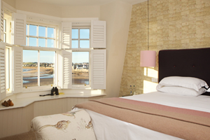
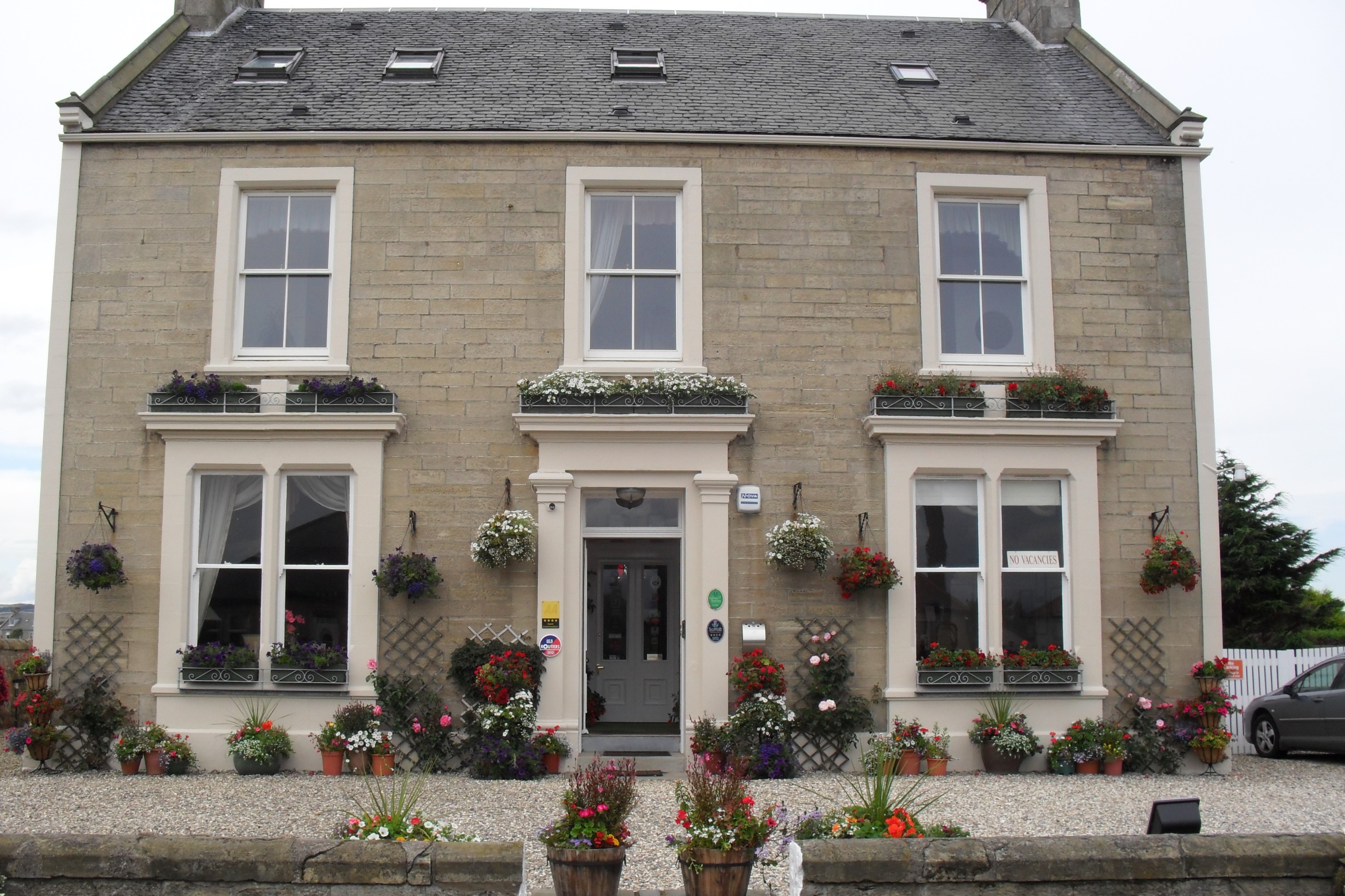
Here are some examples of the accommodation we use along the Fife Coastal Path:
 Dunclutha Guest House in Leven offers year-round hospitality in the heart of Fife. Owned by Julie and Richard, this charming guest house is known for its welcoming atmosphere, impeccable upkeep, and exceptional service. Conveniently located near the town’s amenities and a short stroll from the beach, you’re guaranteed a delightful stay. Visit their website
 The Ship Inn at Elie blends style and comfort with breathtaking views of Elie Bay. Open year-round, it’s a haven for relaxed stays and exceptional dining. Showcasing the finest Scottish produce, from East Neuk lobster to Fife-sourced beef, it offers seasonal menus, cosy fireside meals, beachside barbecues, and local ales. Visit their website
 In the picturesque town of Anstruther Jennifer and Mark welcome you to The Spindrift. An imposing Victorian residence built in 1870 for John Smith, a famous tea clipper captain. Their aim is to provide you with a high standard of service and housekeeping. After a day on the trail take time to relax in the residents lounge or in the reading room. Visit their website
 A warm Scottish welcome awaits you at Cameron House in St Andrews. Building on the success of her parents Elizabeth and Leonard, Donna continues to offer her guests high quality accommodation in a welcoming, relaxing environment. Donna provides a friendly, helpful and unobtrusive service, whilst taking delight in getting to know her guests. Visit their website
General travel information for the Fife Coastal Path will be in your holiday pack.
Detailed instructions on getting to your first night’s accommodation by car, or on foot from the nearest train or bus station, will also be included in the holiday pack on individual accommodation maps.
To view train times please visit trainline where you can also purchase tickets in advance. For information on bus timetables please visit traveline
If you require secure car parking whilst walking this route, please contact us for information.
Getting to Burntisland:
By Air: The nearest International Airport is Edinburgh International. Buses regularly depart to Inverkeithing train station. Take the train to Burntisland.
By Public Transport: There are direct trains from Edinburgh Waverly to Burntisland.
By Road: Burntisland is located on the A921. If travelling from the south, take the M74 towards Glasgow and leave at junction 5 for the M8. Take the M9 until the M90 towards Dundee/ Perth. Continue on the M90 over the Queensferry Crossing Bridge until junction 1C for the A921 leading to Burntisland.
REturning from St Andrews:
By Public Transport: There is a train station at Leuchars with frequent services to Edinburgh Waverly. Regular buses are available from St Andrews to Leuchars train station.
Anstruther
The Isle of May National Nature Reserve sits 5 miles off the coast of Anstruther. There are boat trips out to the island most days from 1st April through to 30th September. Trips last around 4 or 5 hours with half that time on the island itself. Up to 250’000 seabirds can nest on the island. These can include Puffins, Shags, Razorbills and Guillemots. Approximately 150 seals live around the island. Also in the water, look out for Porpoise and Dolphin. If you’re especially lucky, you might even spot a whale!
St Andrews
Add an extra day to savour St Andrews. Famous for its many golf courses, including the Old Course, with the landmark Swilcan Bridge at the 18th hole. You can learn all about the history of the game at The British Golf Museum.
Take time to explore the ruins of St Andrews Castle, with its medieval bottle dungeon. Not too far from the castle is the University of St Andrews, founded in 1413. The Museum of the University of St Andrews (MUSA) displays thousands of artefacts, including medieval maces and stained glass, and covers student life through the ages. Remaining with architecture, the ruins of St Andrews Cathedral, built between the 12th and early 14th centuries is well worth a visit.
Coffee and cake are never too difficult find in the town centre!
| Prices | GBP (£) |
|---|---|
| Accommodation, map & guidebook only | £764 |
| with Luggage Transport | £884 |
Other Options |
|
| Extra Nights (per night) | £95 |
| Single Supplement (per night) | £72 |
| Solo Luggage Supplement (per day) | £24 |
