Kofi the Beagle’s Amazing Lake District Adventure
By Hayley Finn
Fans of my previous work will know I usually walk with my wife and, last year, also my parents-in-law. This year, I have chosen one of Mickledore’s most challenging walks: the Inn Way to the Lake District, a circular route around the entire national park that includes 42 traditional Lakeland inns and many key locations and valleys. The route was devised by guidebook writer Mark Reid. This year, I am walking with the very best companion – my dog!
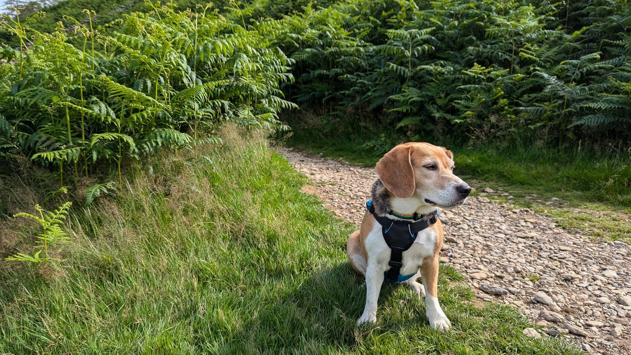
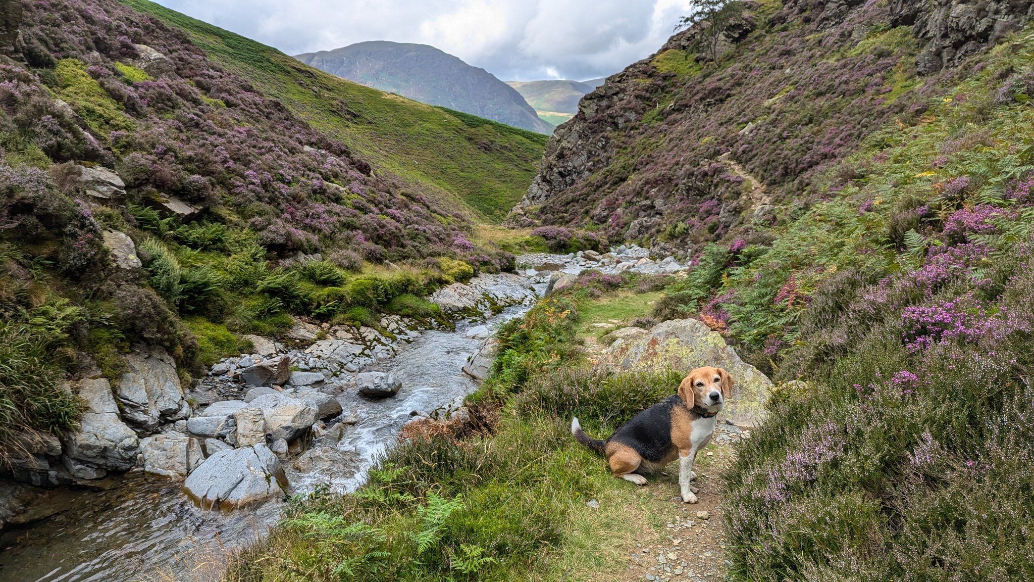
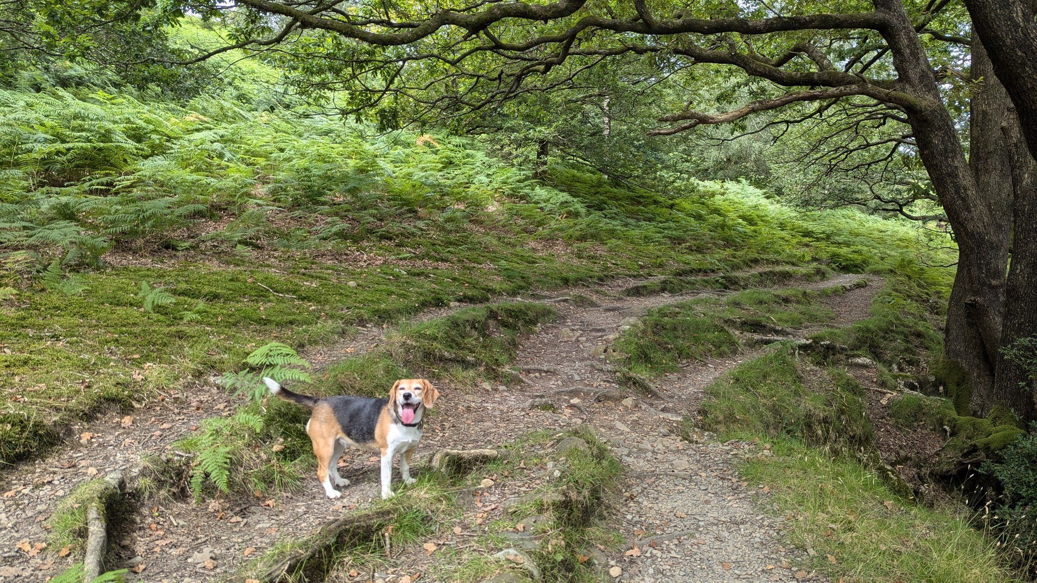
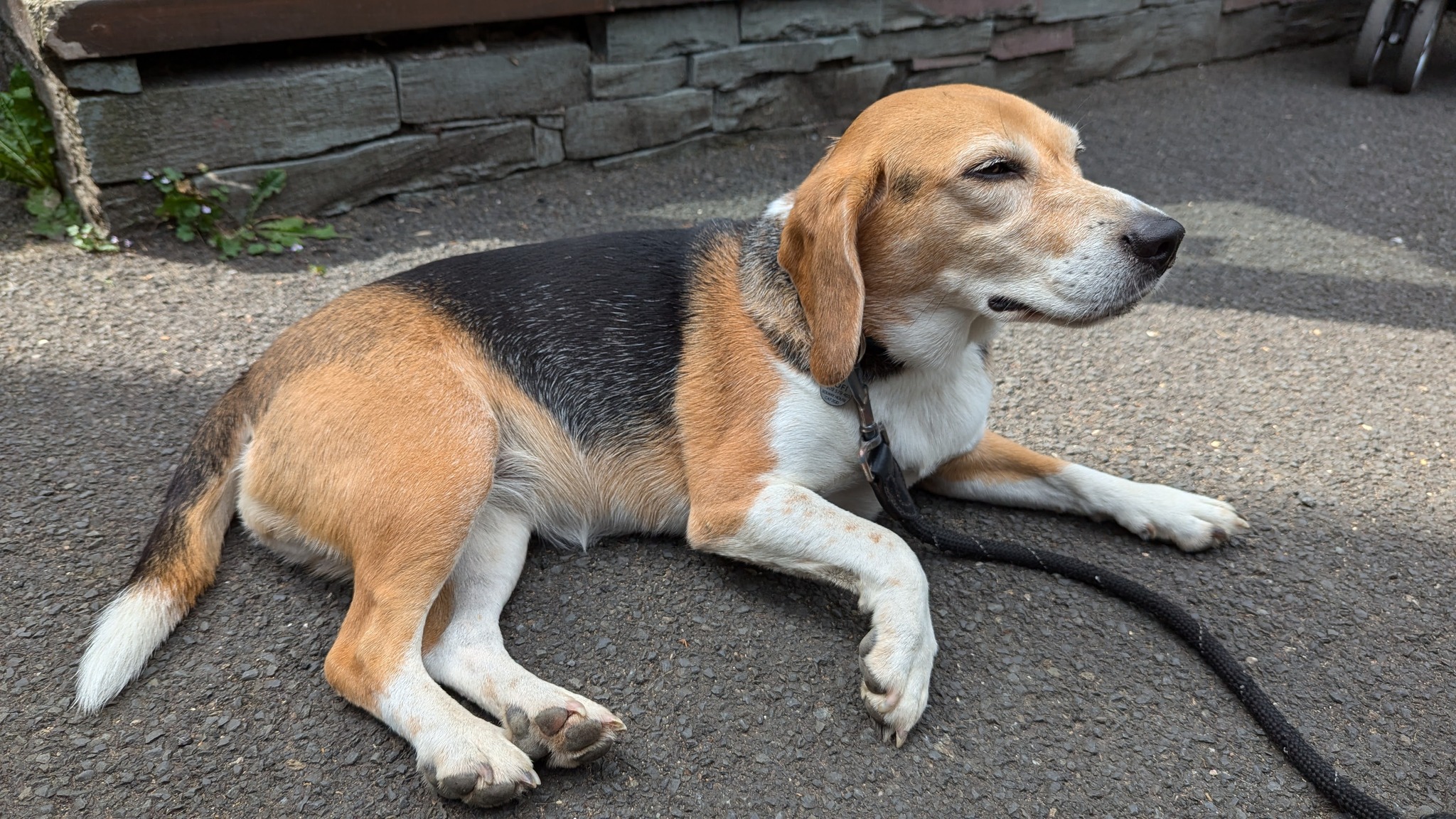
Kofi is a 6-year-old beagle, born and raised in the Lake District. She’s a well-trained fell dog, stays close, and doesn’t bother the livestock or wildlife. She is also very dramatic and overly friendly if we meet anyone having their lunch!
For the last six months, we have both been in training for this walk – me to lose my lockdown weight and Kofi to get her fitness up and ensure her paws and stamina can handle the rocky, rough paths of the route. When walking with your dog, it’s really important to consider their fitness as well as your own. It is a big shock for a dog to go from daily 5km walks on local grassy paths to daily 15km walks on craggy, sharp paths in the Lake District. The last thing you want is to curtail your walk because your dog has developed a limp or torn their paw pads, leading to a big vet bill!
With this in mind, I have already scheduled a potential rest day for Kofi in the middle of the walk when my wife will come and pick her up, take her home for a day, and bring her back that evening. I might swap to our huge trail hound that day, so look out for her.
Day One: Ambleside to Rosthwaite
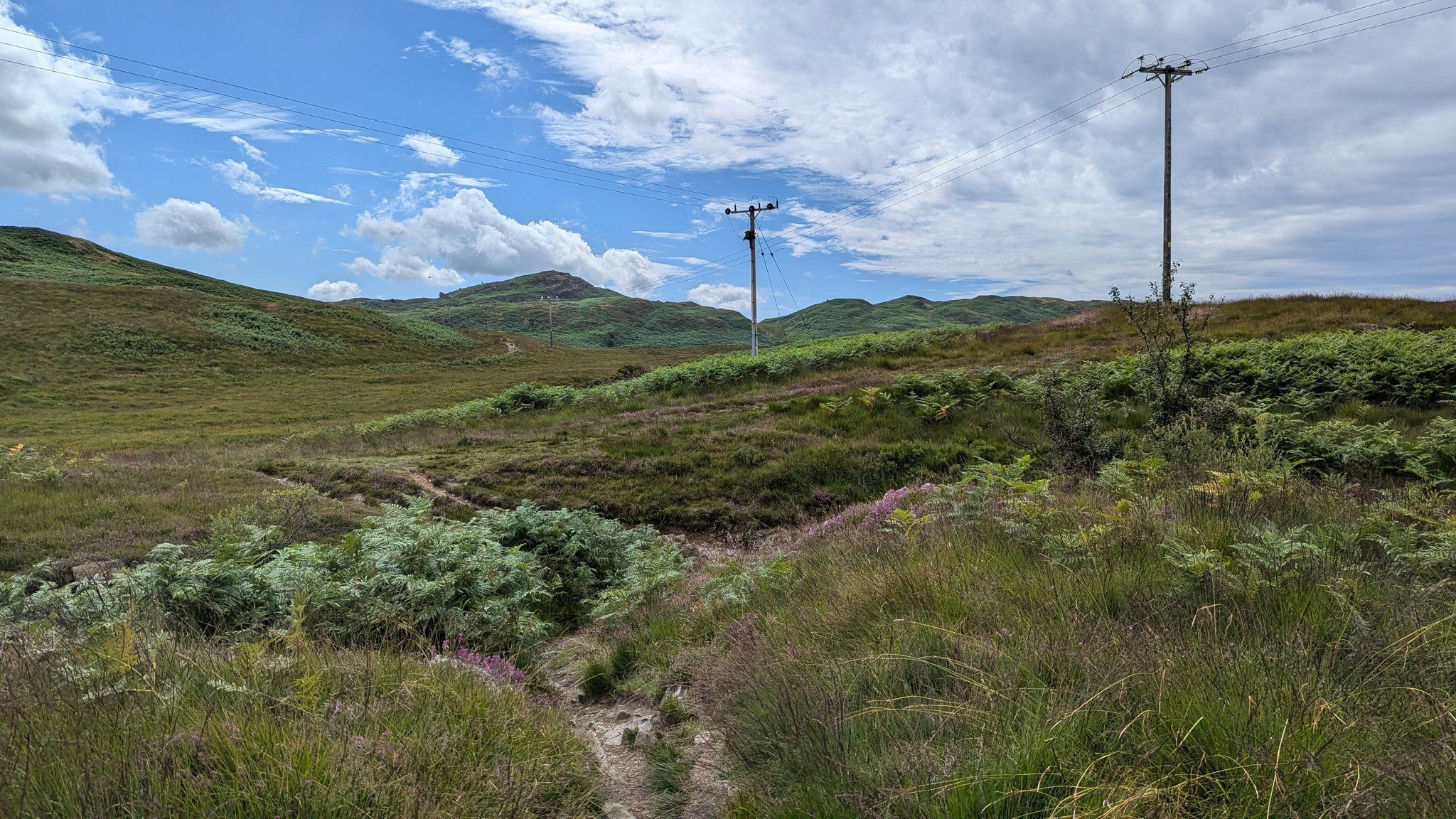
A flat start out of Ambleside. Quickly off the road, we’re now on the Coffin Trail between Grasmere and Rydal, which has some technical bits but no great steep sections, so still a pleasant start. And the weather is good – cool and dry, with the sun poking through. This area is mostly shaded by ancient woodlands.
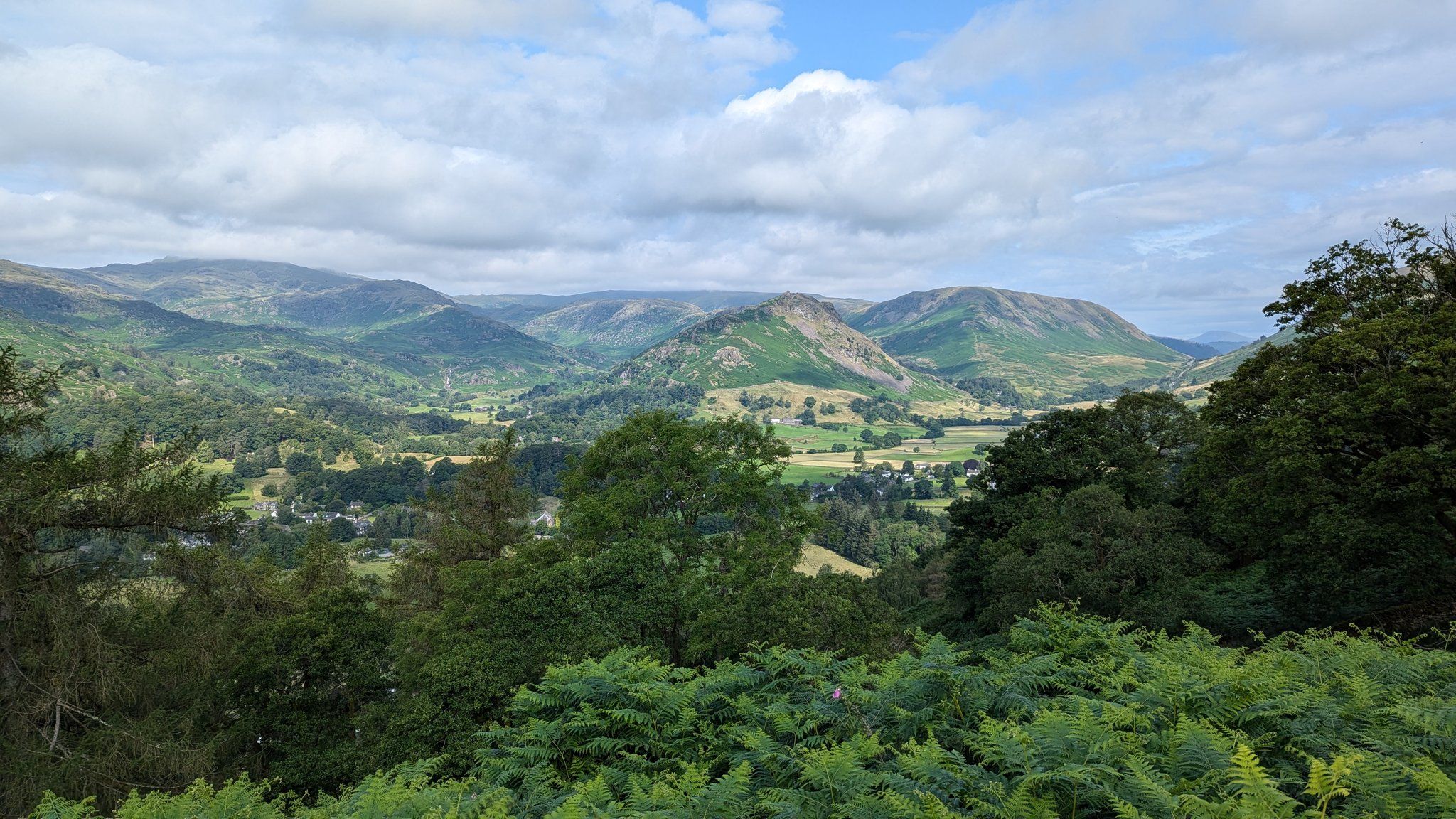
Before dropping down to Grasmere, we come off the Coffin route, having met plenty of people out doing that lovely route. Now we’ve turned off and are heading up our first climb to Alcock Tarn. It’s called Alcock Tarn because it was dammed by a fella called Mr. Alcock. It is a peaceful, quiet area, currently occupied by a group of Scouts.
As we leave, it’s lush and green, and the path is nice. Hopefully, the Scouts won’t catch up with us. The path down from Alcock Tarn into Grasmere is tough on the knees. We’ve met people coming up that way, asking if it’s much further. It is. We’re having a little break before we get to Grasmere, which I imagine will also be busy in the summer holidays. But we’re going to stop there for an hour or so to give Kofi a break and have our lunches.
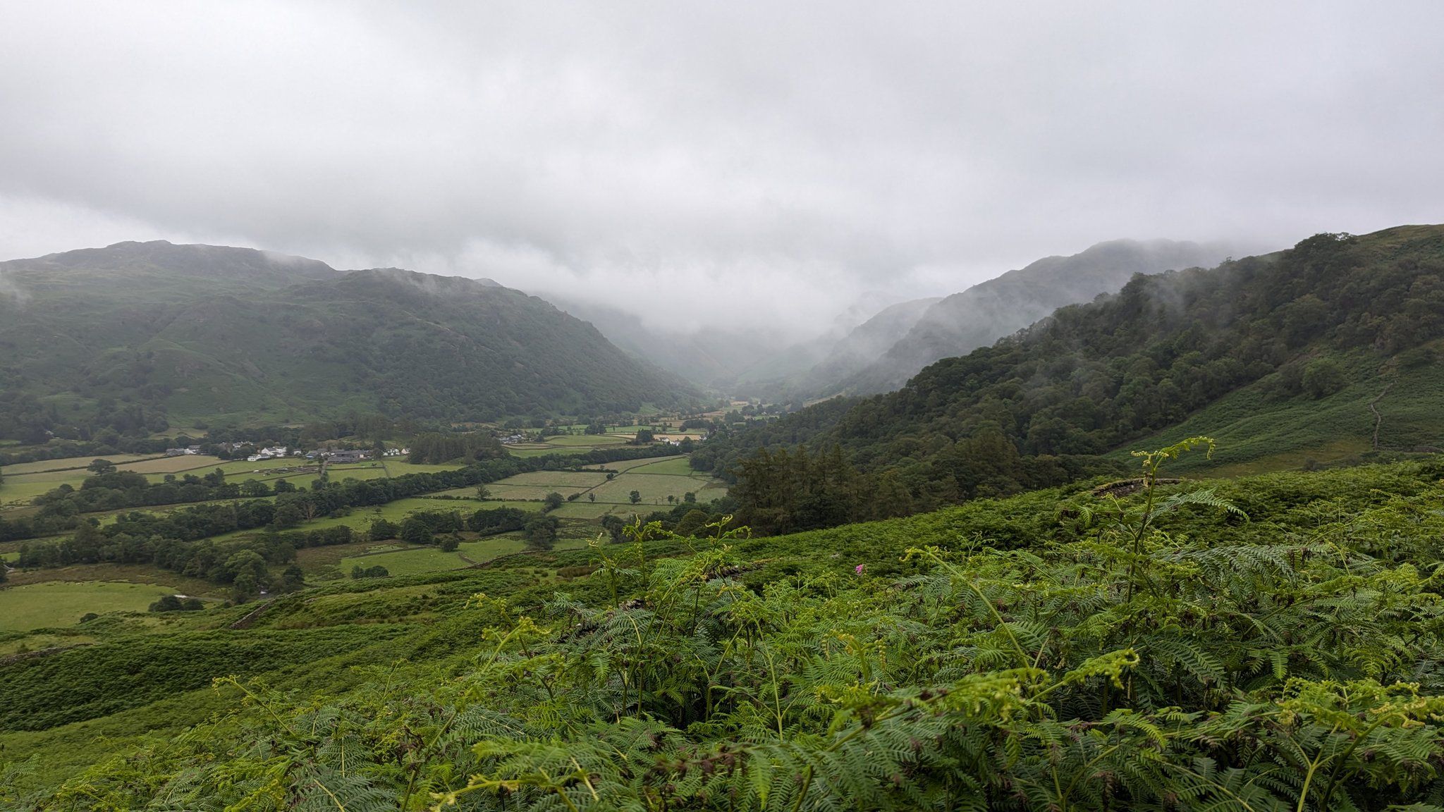
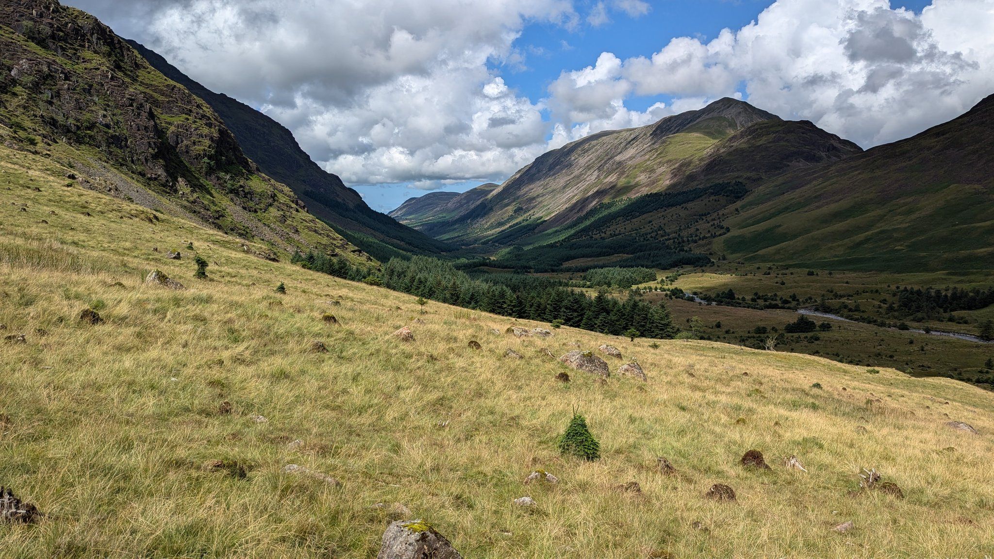
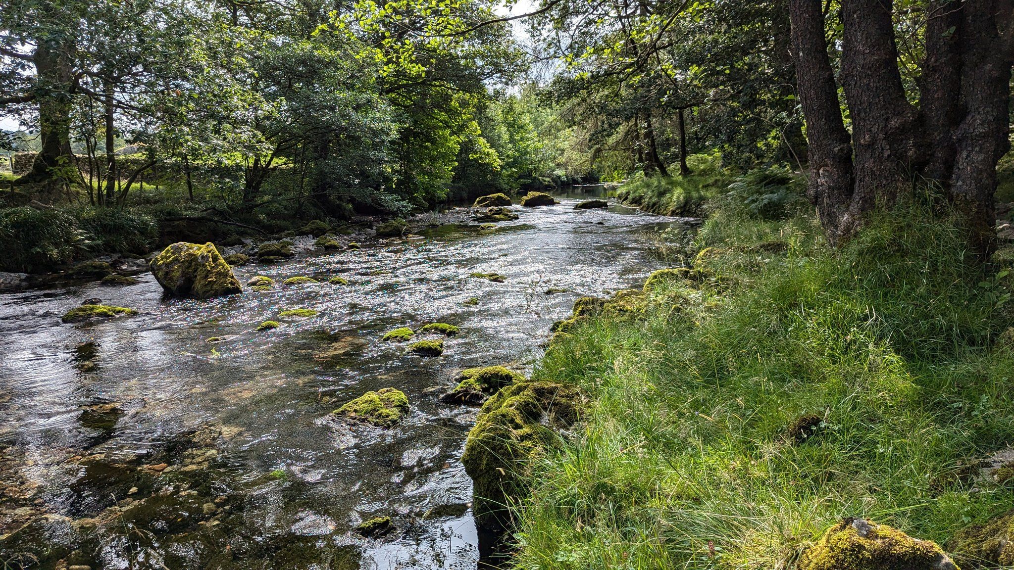
After lunch at Grasmere, we’ve set off for the second climb of the day, over Greenup Edge to drop back down into the Borrowdale Valley. This section starts flat, but it’ll be a steady climb up.
We’ve come through the valley out of Grasmere, and now we’re heading up to Greenup Edge, following the waterfalls. It’s very quiet and isolated with no signal here. Once we are over, we come back down and join up with the Cumbria Way into Rosthwaite.
We’re passing coast-to-coast walkers now coming in the opposite direction to their stops at Grasmere. It’s a very technical descent with some hands-on rocks, coming down Greenup Edge into Borrowdale. After a nice refreshing toe dip at one of my favourite spots, which has restored my feet, we set off for the last few kilometres to Rosthwaite.
There’s a pub to stop off at Stonethwaite if you fancy it, but we are tantalisingly close to the hotel.
There’s rain tonight, but then we’re expecting fog tomorrow, so my compass will be at the top of my bag when I pack it tonight.
Day 2: Rosthwaite to Braithwaite
It’s a wet morning, not raining, but there’s water in the air. It’s a bit of a faff finding our path because all the rain we’ve had this year in Cumbria has meant the ferns are taking over and hiding the paths in thick, lush green. But I know where I’m heading; I know this area fairly well, so I’ll find the path eventually. I’ll just get a little bit wet from all the water on the ferns getting on my trousers.
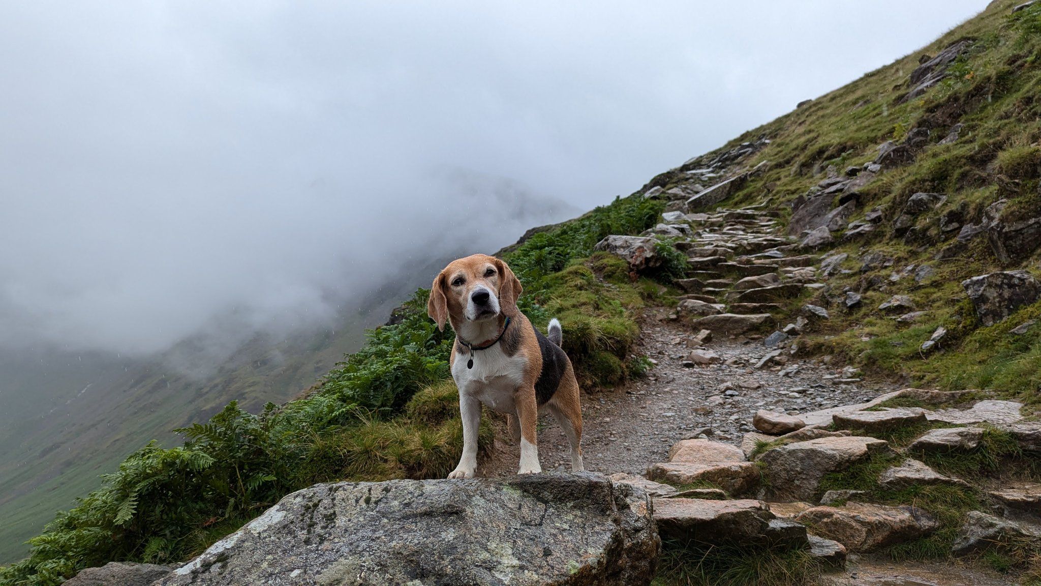
This day starts with the biggest climb of the day up Tongue Gill, which is in full flow because of all the rain we’ve had. Our path is rocky and a bit slippery. You have to take it slow and careful up here. I’ve already passed a Duke of Edinburgh group in training. I don’t envy them carrying all their tents as well. I can’t see the top because it’s just in cloud today, so probably won’t be as many pictures today. But even at its bleakest, it’s still pretty out here. I can’t complain. Kofi is doing brilliantly, scrambling up rocks and finding the path for me.
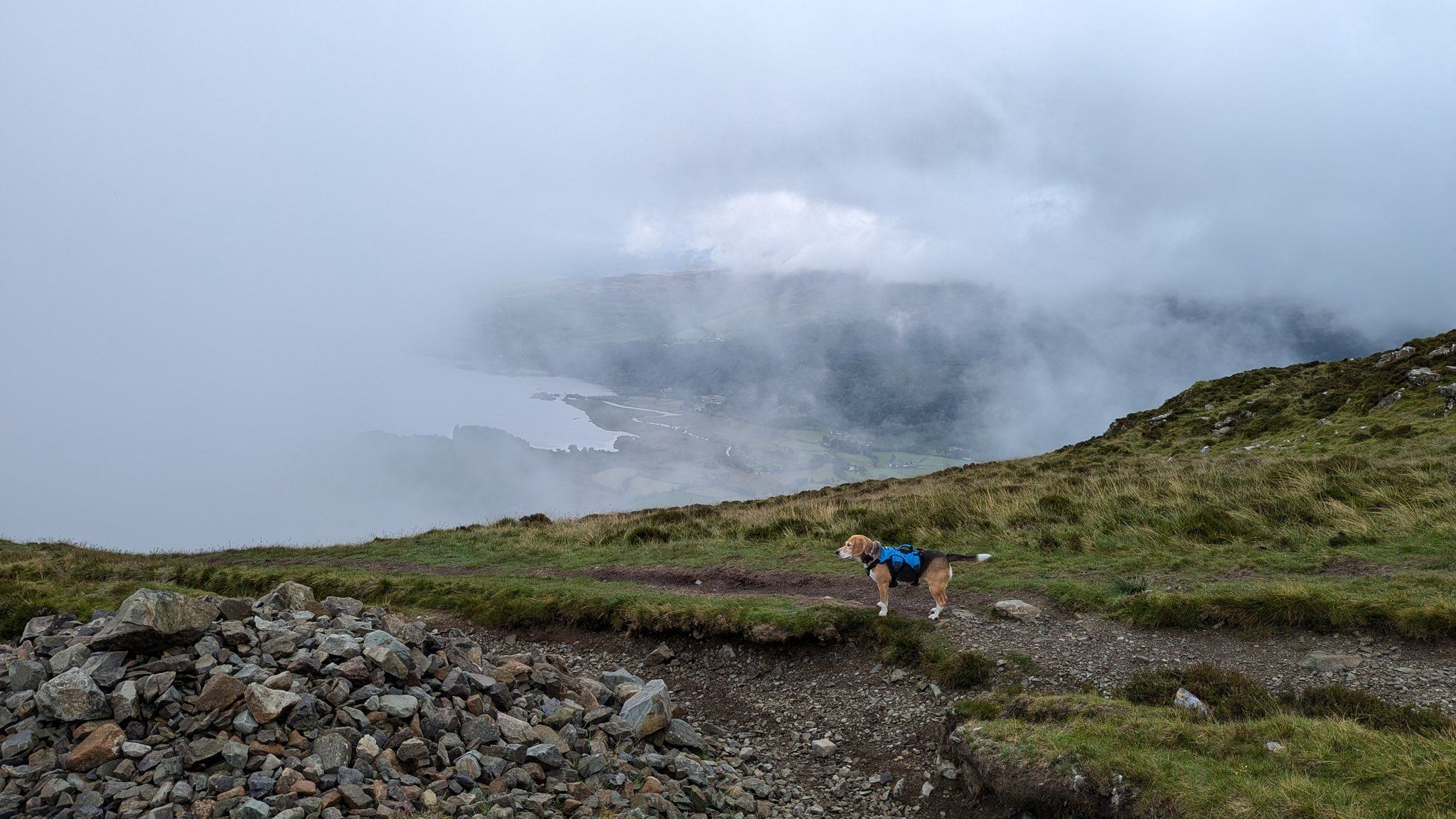
We got to High Spy, our biggest climb today. Absolutely no views because we’re in the cloud. Normally, we would be able to see Derwent Water then behind us, Scafell, down the valley to Keswick, and Bassenthwaite in the far distance, but nothing today. We sat down and had a snack—an orange and some crisps—tucking the orange peel into the empty crisp packet to take it home. We’re now heading off over Maiden Moor towards Catbells, but not going on Catbells. We’re going to drop down into the Newlands Valley and pass by the farms, then slide into Braithwaite. It’s a shorter day today with less climbing and fewer technical bits, which is nice.
The clouds have cleared, and we are seeing more people. We’re heading down and crawling out of my waterproofs. I can now see the path, which always gives me a bit more confidence. We’re now down in Newlands Valley.
After a slightly tricky loose slate path down off Maiden Moor, this is nice and flat. And there are no more climbs today, so a nice easy afternoon for us. After stopping for a drink at the Swinside Inn, we’ve come down the lanes into Little Braithwaite. We’re going to skip the section around Barrow as Kofi and I were doing a training walk there only a week ago.
This will shorten our day a little. One of the benefits of a self-guided holiday is that you can do what you want. We now see the familiar range of Skiddaw. And we’re not far from our Inn for tonight in Braithwaite, where we will have a welcome afternoon nap.
Day 3: Braithwaite to Buttermere
Day three starts on the Force Crag Mine track, which Kofi and I know very well because we regularly walk here with friends and run it with our weekly running group. So, we are happy to be on familiar ground as we now leave the North Lakes.
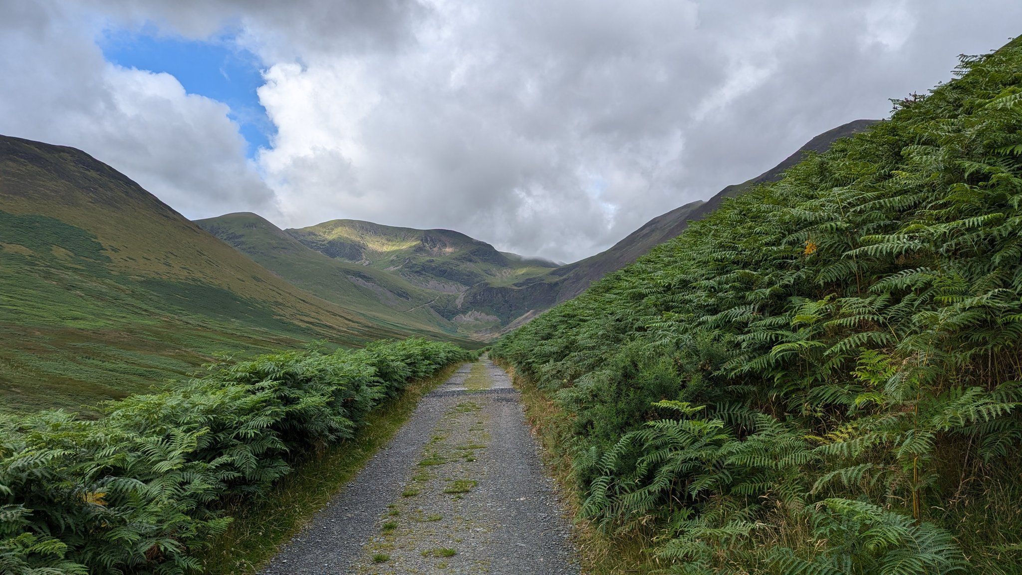
We’re going to head up and over the end of a valley again, with a 650m ascent this time, down towards Loweswater village and the West Lakes, where we’ll spend the next couple of days. Today, we’ve only got one climb to do.
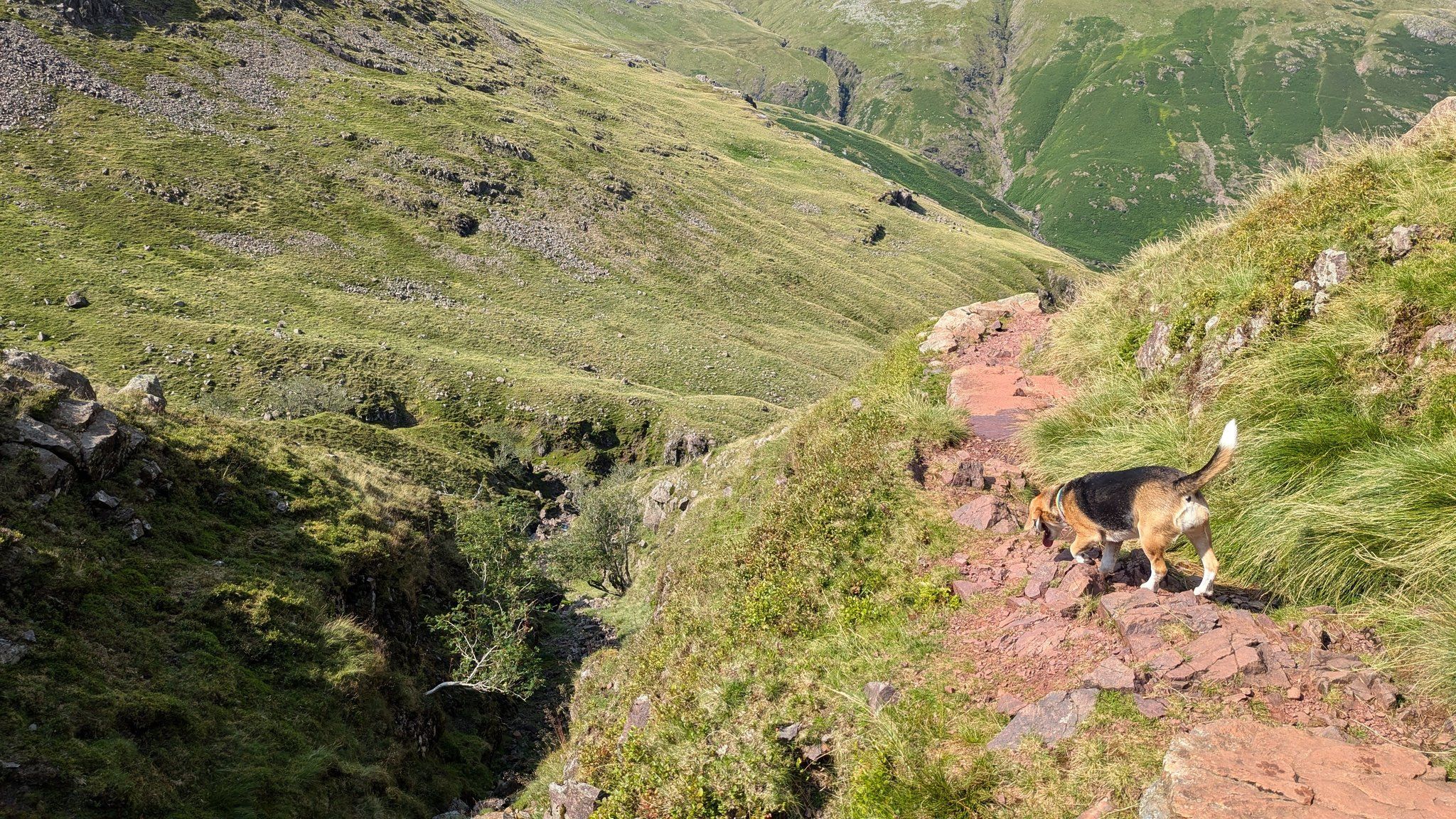
It’s windy up the top, and you need to carefully find the right path down as this is a big junction for walks in the fells. But we quickly drop down into a scree filled and craggy valley with beautiful waterfalls. The path can be a bit treacherous because it’s been wet, so we need to be careful today.
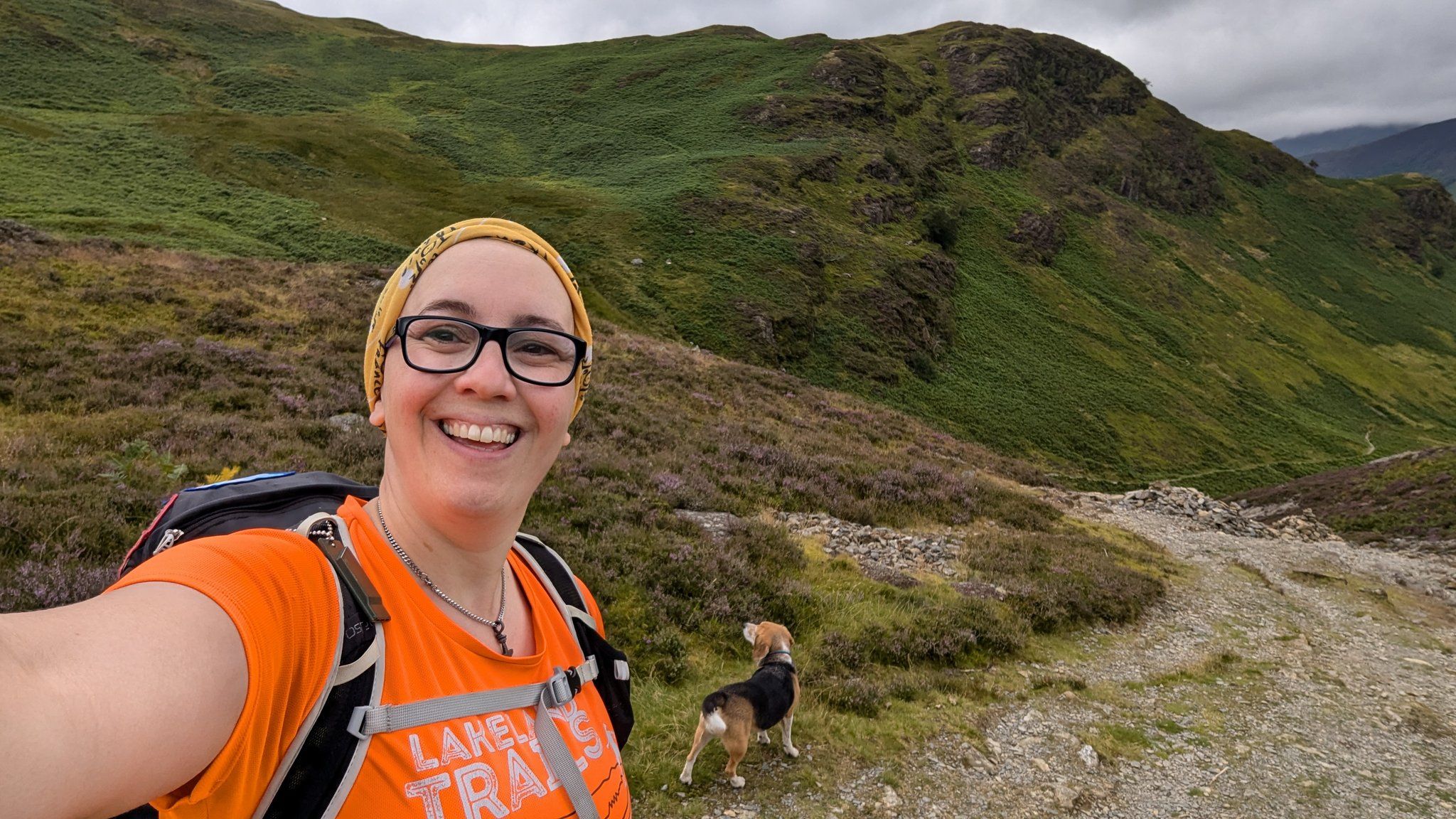
I’ve got one of my walking poles out to help my knees. Because I’m in my 40s now, I have to look after my knees and all my other injuries. But Kofi’s doing well. I thought she might refuse to leave this morning. She wasn’t too keen on getting out of bed, but once I put my boots on, she was up and waiting at the door, eager to go. She’s been happily trotting along behind me and beside me.
The descent out of Gasgale Gill is very technical. Some of the path has washed away, so you need to know where you want to put your boots and be confident in scaling down little plots of rock and muck. But it is more than worth it for what I think might be the prettiest valley I have found in the Lake District so far. There’s heather and fern, wildflowers, and thundering waterfalls. It’s absolutely the most beautiful place. Kofi was a very brave and good dog, needing to be lowered down with her three point harness in a couple of places because she’s quite small for a beagle, but a bigger dog would have no problem.
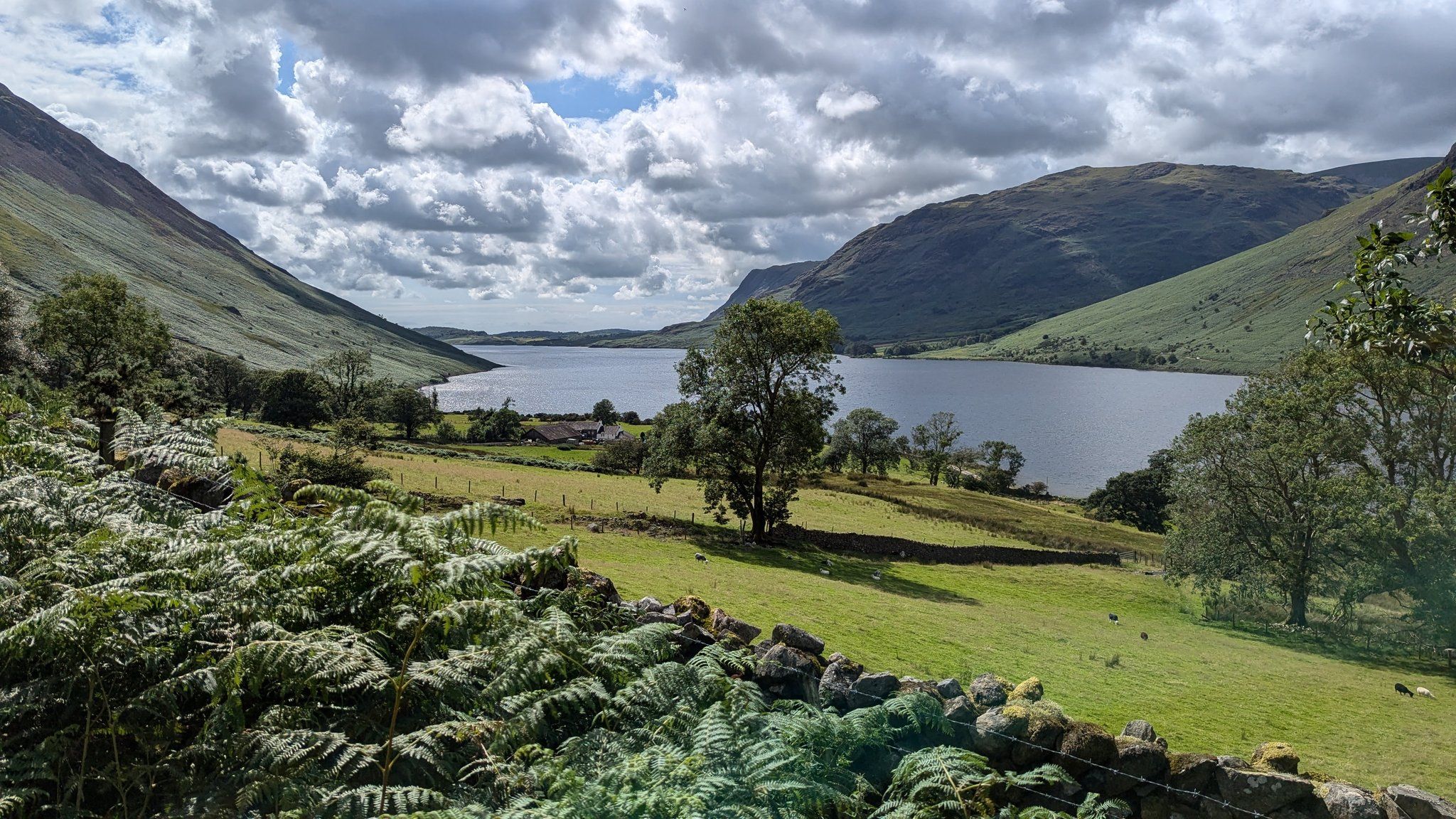
Walking around towards Loweswater village, we are considering whether to take a shortcut just across the top of Crummock Water rather than going into the village itself. Again, with these self-guided walks, you don’t have to follow the absolute set path. If you see a shortcut you’d like to take or somewhere else you’d like to visit, just do it. It’s your day.
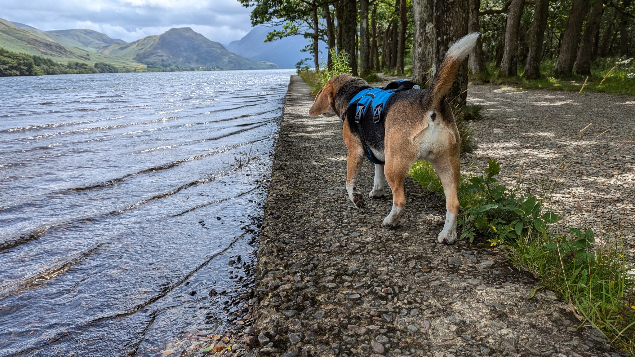
The sun’s finally coming out, and we have a nice walk along Crummock Water to Buttermere village and our inn for the night.
Day 4 Buttermere to Boot
There are two very fine inns at Buttermere, and nothing else: The Bridge Hotel and The Buttermere Court, which was known as The Fish and always will be known as The Fish to locals. I stayed in The Buttermere Court/The Fish. I had a lovely breakfast and a lovely sleep, interrupted slightly by the Lakeland 100 runners coming by around one o’clock in the morning. They were very quiet, but each passage caused the kissing gate to clack. I shut the window.
Today we’re walking to Boot, which has three significant climbs, each about 300-ish meters. When I’m doing climbs, I compare them to our local hill we have walked the most, which for Kofi and me is probably Latrigg just outside Keswick, which is about 350 meters. So, I think today is about two and a half Latriggs.
First, we go over Scarth Gap Pass, then down to Black Sail, the remote youth hostel featured at the end of ’28 Days Later’.
I’ve chosen to go with my trail running shoes today to give my feet a break from my boots. I might regret this because I think my feet are going to get wet. It is currently raining, but it should dry by mid-afternoon. And then we’ve got a heat wave forecast, so I think a lot of wet weather gear is going to come out of my backpack and go into my suitcase. I’ll be getting my hat and sun cream out again.
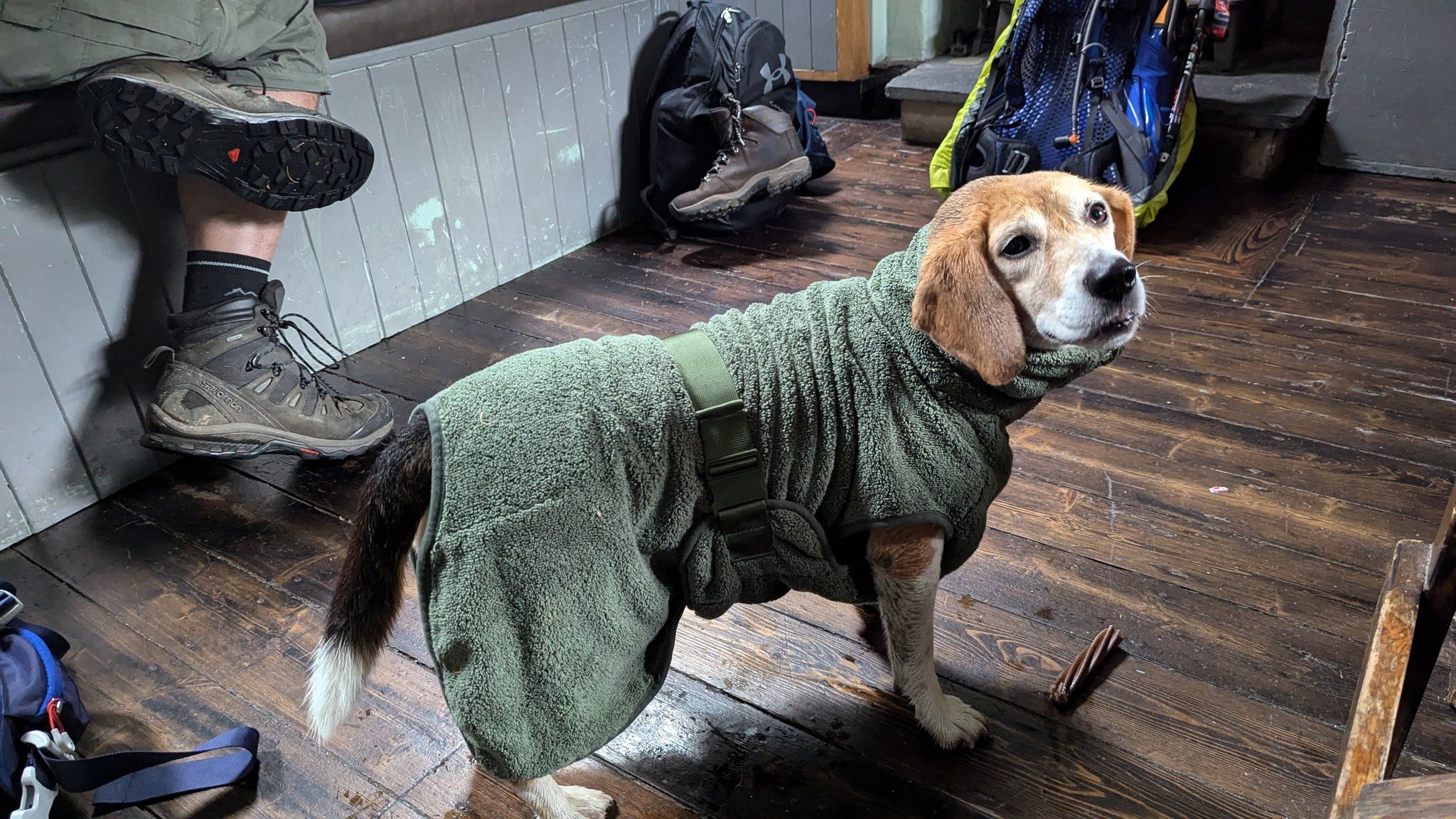
We stopped in Black Sail and met some other walkers who’d stopped for a cup of tea. Kofi got lots of attention and was wrapped up in her dressing gown because we were quite wet when we got there.
Then, when we left the hut, the sun was out, which was a welcome change. Unfortunately, the bridge at Black Sail is gone, and with all the rain I keep mentioning, the stream that you should be able to easily step through was in full flow and about waist-deep. So, i had to take my shoes off, take my socks off, roll my trousers up as high as they go, and wade across with the bag, using walking poles to keep balance because it was quite fierce. I wouldn’t advise crossing this when it’s forceful like this unless you’ve done it before. Once I dropped the bag off, I went back to get the dog who doesn’t like swimming, so I had to hold her harness to help her across, which was tricky. We got quite wet. Luckily, Kofi dries off very quickly because hounds have quite oily fur, which is water-repellent. And my trousers will dry off now that it’s sunny. If it was still wet and raining and we were like this, it would not be a fun climb over Black Sail Pass.
But the sun is out, and I’m taking time to stop on the way down to Wasdale Head to dry out my trousers. I know there’s an outdoor shop there, so I might buy a pair of socks. We had the absolute pleasure of meeting one of the Wasdale farmers, one of his farmhands, and four of his working dogs coming up Black Sail Pass to gather his sheep in for shearing. As we headed down, we could hear him directing his dogs over the scree, bringing in sheep. On the other side of the valley, he’s got two more lads and more dogs. I was silently pleased to see how impressed he was when I told him where I’d come from and where I was going. “Quite a walk, that,” he said.
We’ve now come out of Wasdale after an ice cream and a zero-alcohol beer, and we are heading up a gap between two big fells to get down to Boot. In many places, the path is now a stream, so we’ve had to come back on ourselves a couple of times because we thought we were crossing a stream when actually we were missing a turn.
Less than a Parkrun to go. That’s how we measure distance in our house: how many Parkruns is it? So, just five kilometers, a little bit more up, and then down into Boot.
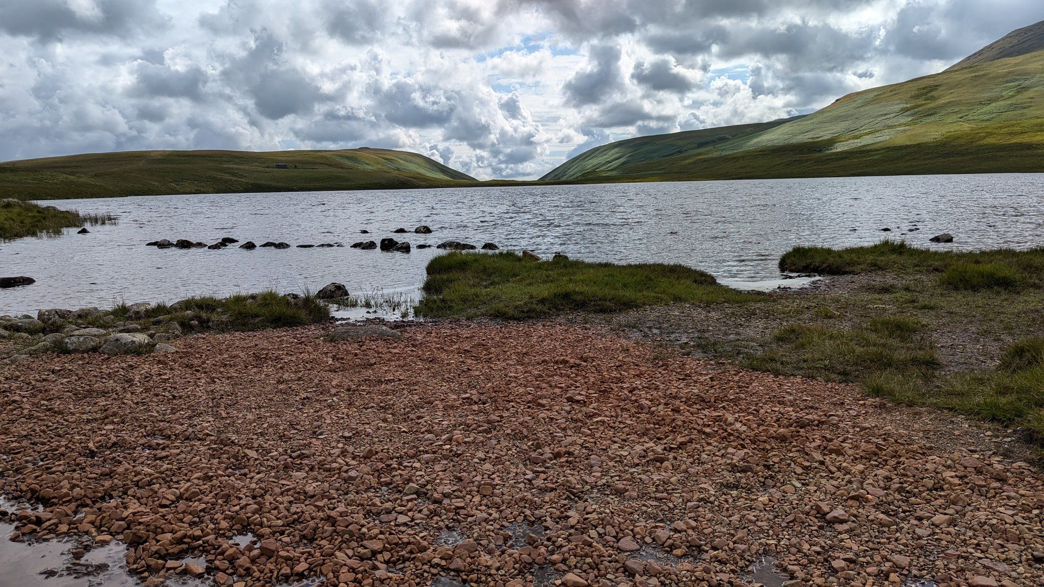
We stopped near Burnmoor Tarn to wring out my socks after we took a slightly wrong turn and walked through a bog. I’m definitely ready to check into an inn now.
I limped down to the Boot Inn after rolling my ankle a couple of times and was ably assisted by staff to my room to consider my options for tomorrow.
Day 6: Broughton in Furness to Coniston
Unfortunately at Boot my ankle swelled up and I’d gotten a lot of dirt into some wounds on my feet so I had to call my wife for a quick lift home to clean everything out properly, strap it up and take a days rest, missing the Boot to Broughton in Furness section. I was really disappointed because I love the Eskdale Valley and south of it is an area I have never explored before.
But I was unable to walk that day and so my colleagues in the Mickledore office took care of changing my arrangements for accommodation and luggage moves to allow me a day off walking to recover. If you do find you need to suddenly take a days rest do call the Mickledore office to get advice and assistance with your arrangements.
Today I rerouted myself slightly to take an easier walk into Coniston from just south of Torver. My wife dropped me off then joined Kofi and I halfway there after popping my luggage into the Inn for me.
In this section the Inn Way does use some of the Cumbria Way so we chose to stay on the Cumbria Way and take the flatter shorter route into Coniston to ease my left ankle back into the walk after rolling over it twice on Saturday.
This is a beautiful walk along the water of Coniston, quiet until you are closer to the village of Coniston which is a popular tourist town for day visitors and campers. My inn tonight is in the centre of town and Kofi is glad of the shorter day since it’s now finally summer in Cumbria!
Day 7: Coniston to Langdale
Finally, a full sunny day!
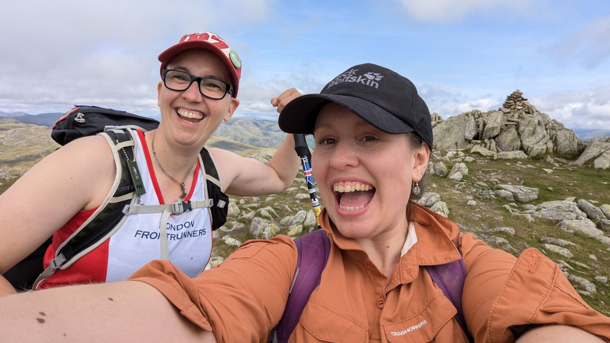
My friend Katie is joining me for the last two days. She lives in Kendal, so she took a bus (still only £2 for all buses in England this summer) to Coniston to meet me after my breakfast. Kofi loves to see Katie because seeing her means we’re going on a big adventure, as she is my regular walking buddy.
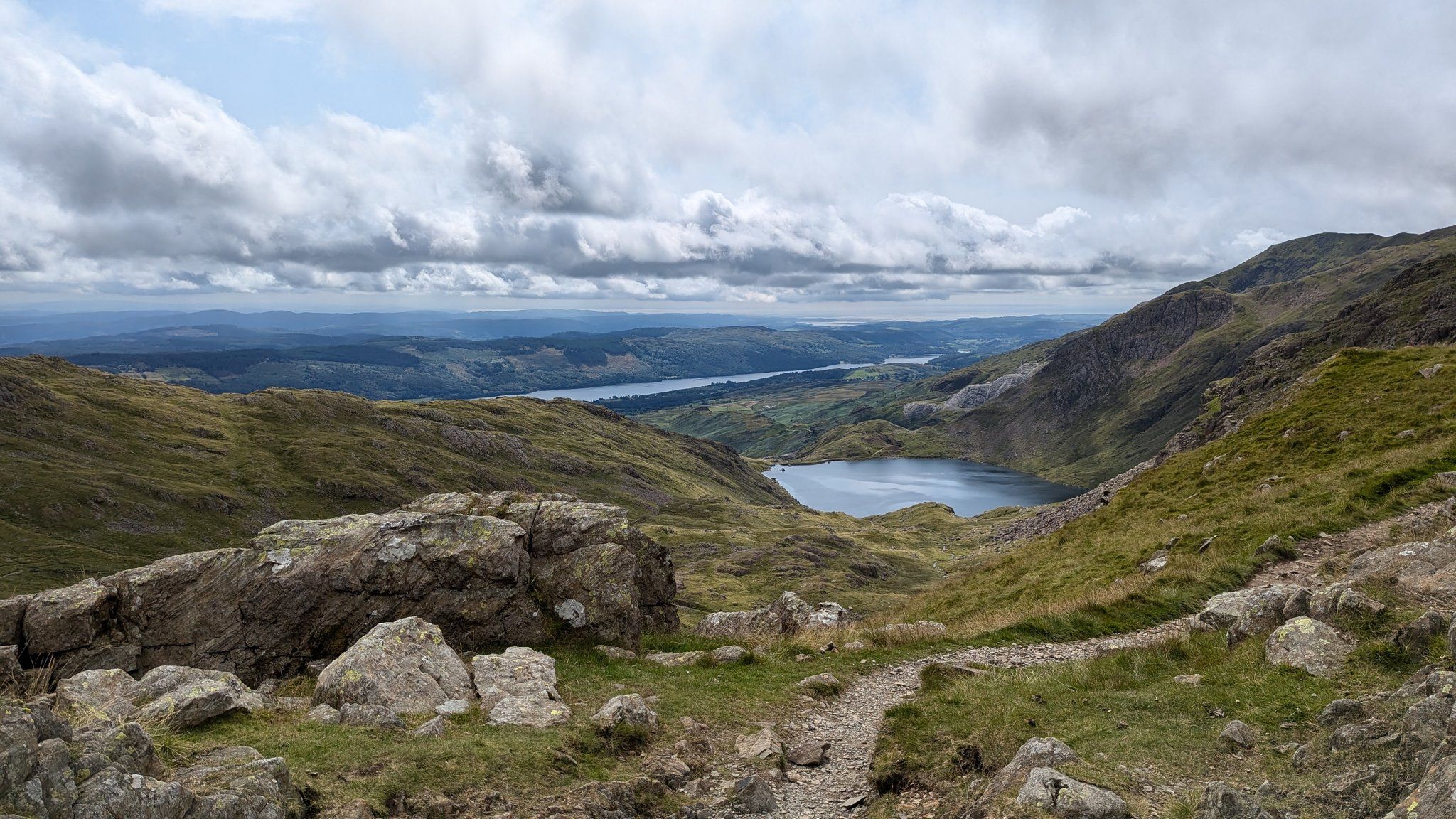
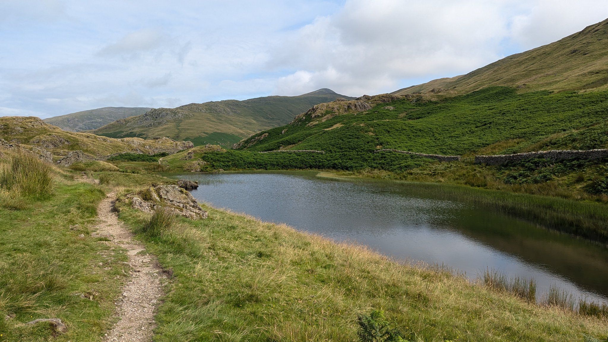
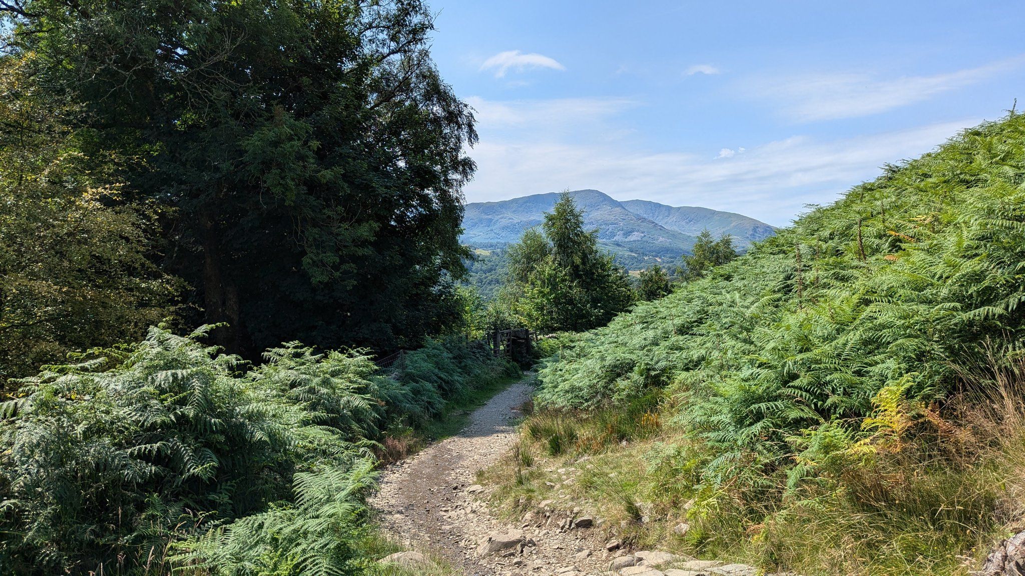
We set off on the big climb for the day: 750 meters up Swirl How. It’s a steady climb with only a few hands-on-rock moments. We passed Levers Water, a small reservoir with spectacular views of Coniston Old Man.
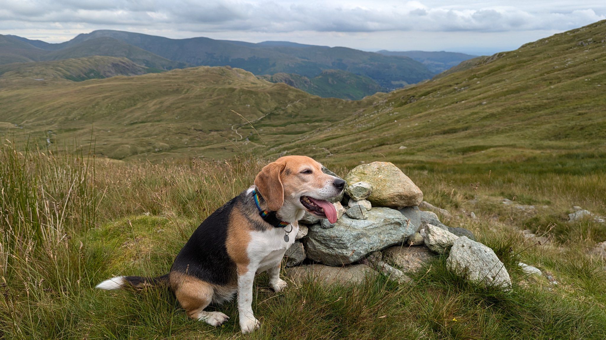
I am really looking forward to these last two days. Coniston is the centre of the lakes, and on a clear day like today, you can see everything. At the top of Swirl How, we could see Skiddaw, Scafell, the Irish Sea, the Isle of Man, and all the way across to the Yorkshire peaks. Worth the climb.
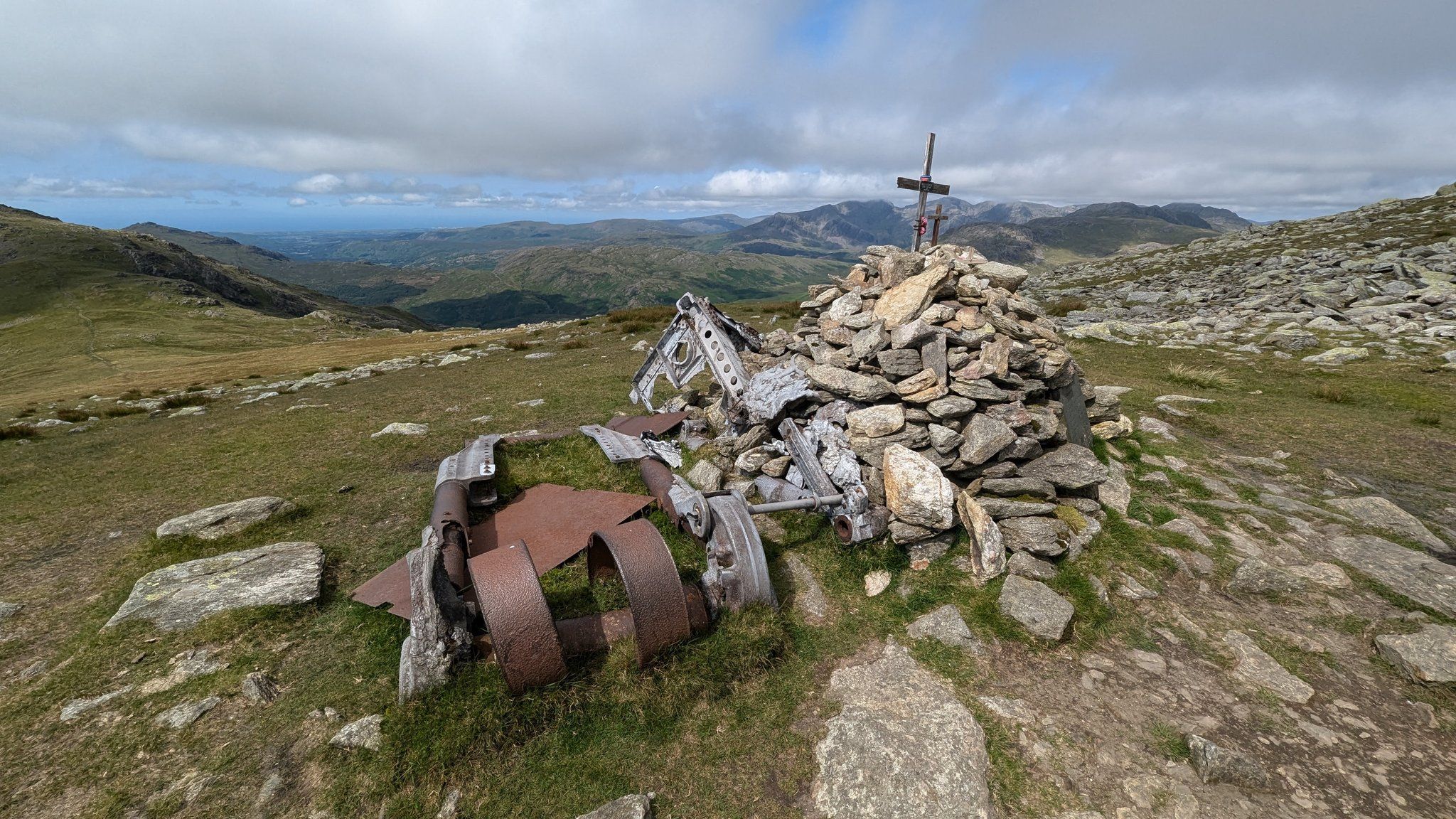
We met a lot of people along the way. There are numerous routes to all the different fells and many valleys in this area. There is also a memorial to a plane crash in 1944 with some of the plane incorporated into the cairn.
Heading down to Wrynose Pass, it really started to get hot, and more suncream was slathered on. Kofi kept cool by stopping at streams and ponds. We made a steady route around Pike o’ Blisco and into the Langdale Valley. I have to say, I was happy to get onto level ground as I’m carrying this ankle injury very carefully now.
The route then follows the river through livestock fields, navigating a small group of cows and plenty of campers, until we reached New Dungeon Ghyll. The biggest room I’ve been given by far, and a nice big bathroom which was a relief since Kofi had rolled in unknown animal pee and stank awful! The water here is from a natural direct source, so it’s slightly brown-green. Absolutely nothing to worry about and very good for my aching muscles. Katie has headed home to Kendal and will meet us again for the final leg tomorrow.
This was probably my favourite day, helped by the weather but the views are just everything you want from a day out in the fells.
Tomorrow is a short, flat day to Ambleside. A lie-in is planned and a stop at our very favourite vegetarian cafe at Skelwith Bridge.
Day 8: Langdale to Ambleside
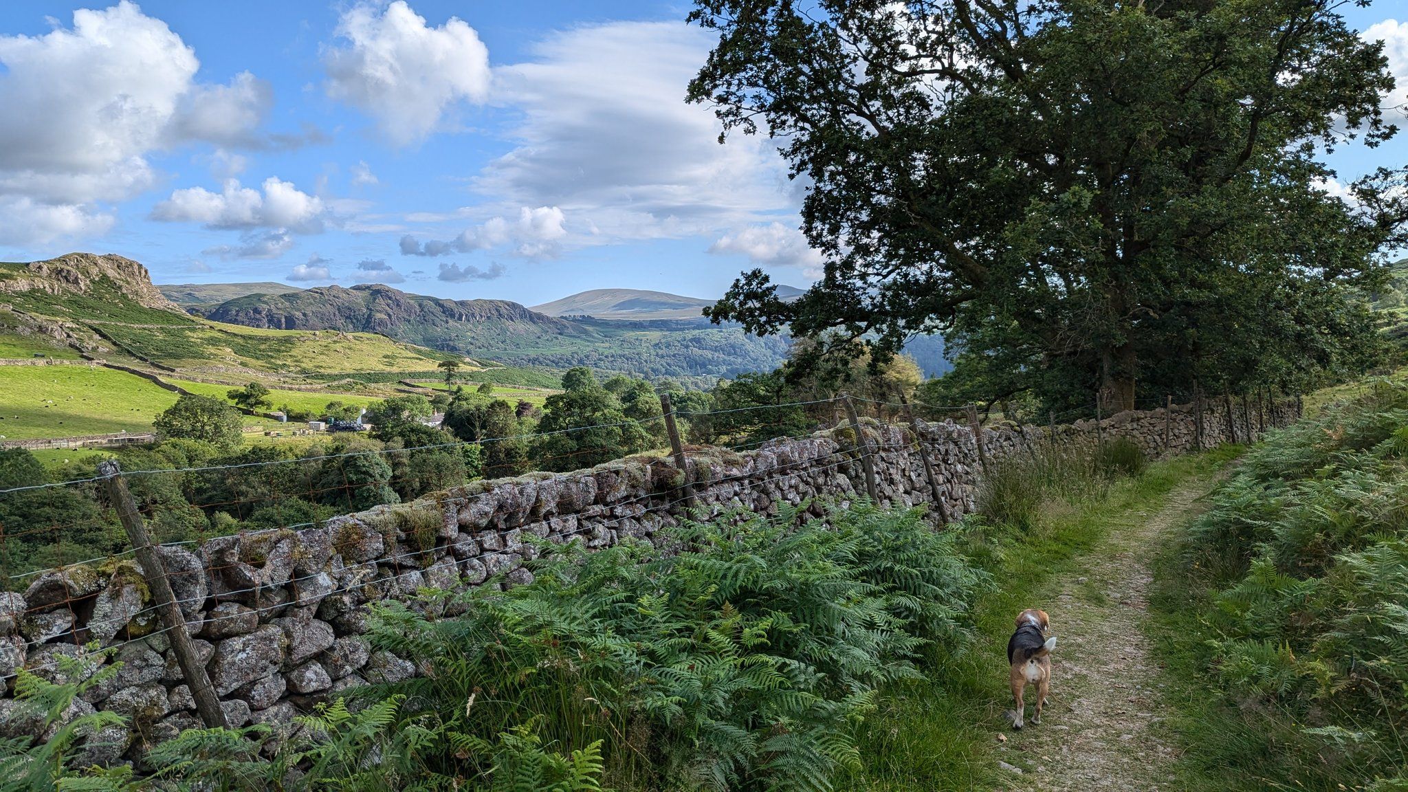
Our final day! We had a lovely night at New Dungeon Ghyll in the Langdale Valley. The last day on this itinerary is a pleasant, short walk along the valley to Ambleside, just seven miles with no big climbs. There is one pub to pass by along the way, The Wainwright.
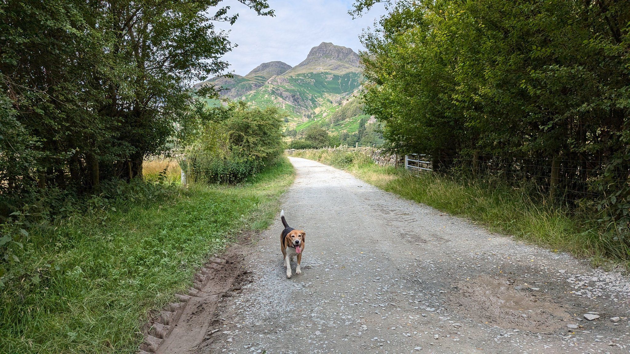
There are many routes down the valley, and when Katie arrived back on the bus, we discussed what to do as it was already scorching hot. Spending all day out on the exposed paths wasn’t wise for us or Kofi, so we rerouted ourselves slightly to stay closer to the river and shaded woodlands on the banks until we got to Skelwith Bridge and our favourite vegetarian café (Katie and I are both veggie and share a love of good food).
This is a busy valley, popular with campers and summer camps, so we were following and being followed by groups of friends and teenagers, most stopping for dips in the river. There are routes off up many fells and plenty of climbing spots too.
We passed farmers discussing how to pull out a fence to get a tractor and trailer into the field. We went through farmyards, passed herds of beautiful cows, and earlier, a farmer had come running through the hotel residents’ garden chasing a loose ewe he had lost a couple of days before. This is a working valley.
After an exposed section past Loughrigg Tarn and around Loughrigg Fell, it was hot, but thankfully the streams were still in spate, so there was plenty of water for Kofi to hydrate and cool her paws along the way.
Coming down into Ambleside, I felt a sense of achievement. Despite having to miss a day due to injury, I felt all the better for having completed my challenge walk rather than giving up.
Walking solo (with my dog) was never a worry for me. I’m confident with my map reading and compass skills, and I have always felt safe with others out on the fells. We had a couple of hairy moments crossing a river and getting down some rock faces, but we made it. If we had gotten into trouble, my accommodations would have notified my colleagues that there was a walker missing.
This is a tough route that requires some map reading and compass skills but also allows a lot of flexibility for route options. I’ve seen valleys I would never have normally considered, like Gasgale Gill, and stopped off at places I wouldn’t regularly visit, like Black Sail YHA hut. Spending this kind of quality time with Kofi has been wonderful. We have formed some core memories, and I hope she has enjoyed it as much as I have.
If Hayley and Kofi have inspired you to walk the Inn Way to the Lake District email us [email protected] or call us on 017687 72335 to speak Hayley and our friendly team of walking holiday experts.